
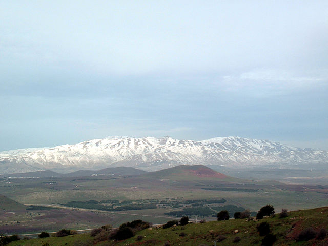
Mount Hermon (Jabal el-Sheikh) has been a Druze stronghold since the founding of the faith to the present day. It is surrounded by Druze villages on all sides, and its location is considered the center of major Druze communities in Syria, Lebanon, and Palestine.
On its northern slopes lie the city of Hasbaya and Druze villages, while on its southern slopes are the villages of Majdal Shams and Mas'ade. On its western slopes lies the village of Ain Qinya, and on its eastern slopes, nearby, lies a group of ancient Druze villages, led by the village of Hader, and a number of villages in the region extending between the mountain and the outskirts of the capital, Damascus. These villages have played a major historical role in the events of the Druze community and the region, especially during the Great Syrian Revolt, and continue to do so today.
Hader Village
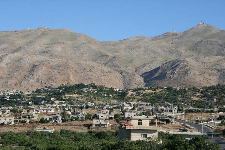
This is one of the villages of Mount Hermon in the Syrian Golan Heights, located 75 kilometers southwest of Damascus. The village is situated on the eastern slope of the volcanic mountain that forms most of the land of Quneitra Governorate. Within the village's lands lies the main volcanic crater, and there are a number of caves in and around the village, surrounded by beautiful nature. The population of Hader is 14,000, and most residents work in the cultivation of fruit trees, such as figs, cherries, and others. Hader is characterized by its pleasant climate, moderate temperatures, and stunning scenery. Hader is considered one of the largest villages on the Golan Heights in terms of area, the most abundant in trees and fruits, and features some of the most beautiful nature and views of the majestic Mount Hermon. The total area of land in Hader reaches 35,000 hectares, of which 1,000 hectares are planted with over 160,000 fruit trees, including 56,000 apple trees, 35,000 fig trees, and 60,000 olive, almond, grapevine, and Syrian mulberry trees. The village has five schools, an extension unit, a sports club, and a cultural forum. Forty percent of the residents hold high school diplomas, and 12 percent hold university degrees.
Arneh Village
The village of "Arneh" is located about 60 kilometers southwest of Damascus and about 30 kilometers southwest of Qatana, on the southeastern slopes of Mount Hermon, at an altitude ranging between approximately 1380-1450 meters. It can be reached from Qatana by passing through the villages of Aysam and Qal'at Jandal. It is an agricultural village rich in water, with 365 springs bursting from its lands in the spring months.
There are several possibilities for the origin of the name. The first is that it comes from "Al-Areen," meaning the high area, which transformed over time into "Arneh." The second suggests that the lands of "Arneh" were marshes, and when the water moved due to the wind, it made a sound like "arnat... arnat," which also turned into "Arneh" over time. The third possibility attributes it to a bird native to the water marshes of "Mount Hermon," similar to the current "Marabou" (Abu Sa'ad) bird, which was called "Arneh" at the time. There is also an opinion that the name "Arneh" dates back to the "Hurrian-Aramaic" tribe that inhabited the southeastern slopes of Mount Hermon.
The majority of Arneh's 4,600 residents work in agriculture, and there are a large number of civil servants and those working in independent professions; the number of university graduates among the villagers has recently increased. The village has many historical monuments that speak to its past, starting from the "Shabib al-Tubba'i" palace at the mountain peak to the remains of ruins, fortresses, and ancient tombs scattered around it, indicating it is an ancient town with a long history. The oldest known antiquities date back to the Roman era. A stone from the "Zeus" temple remains in the village in front of one of the residents' houses, inscribed with eleven lines in Greek mentioning the "Zeus" temple in "Arneh." On the mountain slope overlooking the village, at an altitude of about 1700 meters, are the remains of two temples dating back to the Roman era, which people call "Shabib al-Tubba'i Palace" and the "Qasr Antar" temple, which is located near the peak of Mount Hermon (2714m). Arneh is a beautiful tourist town; its climate is moderate in summer and cold in winter, and it is distinguished by its magnificent scenery and abundant, fresh water.
Ain al-Shaara Village
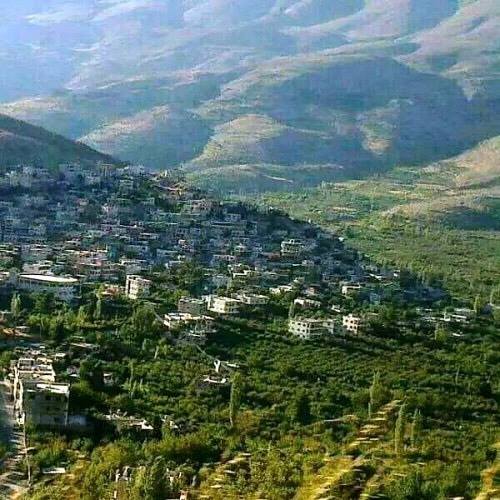
The village of Ain al-Shaara is located on the slope of Mount Hermon, overlooking slopes and plateaus extending to the capital, Damascus. It falls under the administration of Qatana city - Hermon district, 65 km from Damascus, at an altitude of 1450 m above sea level. From there, one can see the four governorates of Damascus, As-Suwayda, Daraa, and Quneitra, in addition to Mount Qasioun and Damascus International Airport when the weather is clear. The population is about 5,000.
The village and the region generally used to see significant tourist activity in normal circumstances due to its natural beauty and pleasant weather, in addition to church scout camps and others that visit it throughout the year. The village has been and still is a destination for television directors, and many Syrian series and films have been filmed there. It is famous for its moderate summer climate and its vineyards, as well as olive, fig, almond, walnut, mulberry, apple, cherry, and apricot trees. It is also home to some beautiful types of birds, such as partridges and others, both resident and migratory.
It is divided into two parts: the Upper Neighborhood and the Lower Neighborhood. All its inhabitants are Christians and Unitarians (Muwahhideen) from the Bani Ma'ruf, who coexist in rural affection. It has three churches: the National Evangelical Church, which follows the National Evangelical Synod in Syria and Lebanon; Saint George's Church for Greek Catholics; and Saint George's Church for Greek Orthodox, as well as a Druze prayer house (Khalwa). There is a water spring in the Upper Neighborhood and one in the Lower Neighborhood, both distinguished by their beauty; the villagers drink from them, and they are a meeting place for the youth, known as "The Spring" (Al-Ain).
The people of the village sing about the spring during their occasions and celebrations, and some revive the tradition of "dressing the groom" at the spring. Other tourist attractions include the Pigeon Cave, the Valley, the Makhada Spring, the lands below the spring, and Ras al-Matl, which overlooks the village of Khirbet al-Sawda and Wadi Bahran (the Awaj River). The original name of the village is Ain al-Shaara, with the 'Shin' quiescent and stressed, relative to the "Sha'ra" of Hermon, meaning the forest of Hermon, which is Mount Hermon. In the Arabic language, "Sha'ra" is a synonym for forest, alluding to the density of its trees like hair. Thus, the name means "Spring of the Hermon Forest." The spring for which the town is named also attracted folk poets (Zajjaleen), who would exchange verses there and take pride in it. Ain al-Shaara is considered one of the oldest villages to attain education, and it has a very old school known to the elderly in the region, where they used to go to have letters from their expatriate relatives read. The people of the village take pride in the high percentage of their children who have completed higher education, especially in the fields of medicine, engineering, and teaching.
What distinguishes the village most is the high percentage of intellectuals and educated people; there are 36 university professors, as well as many doctors, engineers, and university degree holders. Almost every house has more than one doctor, engineer, or lawyer, as "Ain al-Shaara" is considered one of the highest villages in Syria in terms of education percentage relative to population, according to a study issued by the Statistics Office in Syria.
Its people have inhabited it for more than two hundred years. Some went from "Aleppo" to "Lebanon," and from Lebanon they came to this spot and settled in it. Others came from "Palestine" via Lebanon as well, reaching "Ain al-Shaara"; these are the residents of the "Upper" neighborhood. As for the "Lower" neighborhood, as the locals call it, they arrived from various regions during missionary missions, including some from Lebanon, "Damascus," and elsewhere. It is bordered to the south by the village of "Hayna," which is about five kilometers away, and to the north by the village of "Khirbet al-Sawda," which is located on the side of "Wadi Bahran" and is in a lower location than "Ain al-Shaara," which is about three hundred meters above it, and about two hundred and fifty meters above "Hayna." It is also bordered to the southwest by the village of "Darbal," and to the west by the village of "Arneh."
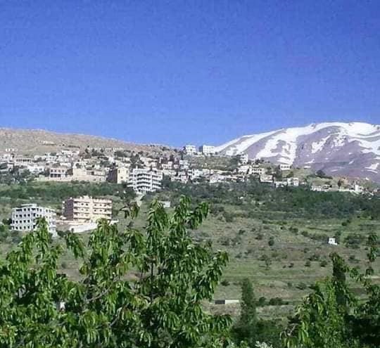
Buqasam Village
Buqasam is a Syrian town located in the Rif Dimashq Governorate, about 44 kilometers south of the capital, Damascus. It is administratively part of the Sa'sa' sub-district in the Qatana area. It is one of the villages of Mount Hermon (Jabal el-Sheikh), located at an altitude of 1850 meters above sea level. The population of the town was 12,148 according to the 2004 census. The village of Buqasam stands tall with its beautiful nature, fruit orchards, flowing springs, and kind people. Despite the coldness of this village, which still retains its old architectural style with some renovation, many of its residents reside there in the winter, having adapted to the cold climate, which has led it to be classified as the highest inhabited area in Syria.
Opinions differ regarding the naming of Buqasam. One local story says that in the days of old wars and invasions, the people of the village defended their village ferociously, and any enemy who tried to approach would be dealt with and eliminated, until everyone feared approaching it, so it was called "Baqa' Sam" (A place of poison). It consists of two syllables, which eventually came to be written as one word: Buqasam. It is worth noting that some pottery pieces and bracelets were found in the village, as there is an archaeological ruin to the south of the village dating back to the Roman era. Its old houses are built of stone, mud, and wood, and each house consists of several rooms, the most important of which is the storage room, usually outside the house, where every family stores what it produces from dairy products, meat, and fruits for other seasons. As for its modern houses, which began with urban development and are increasing gradually, they are built of cement but generally retain the old character and are mostly not multi-story. The people of Buqasam live on agriculture, and they grow fruit trees, such as grapes, figs, olives, cherries, and apples, in addition to modern crops like apricots and greengage plums, which ripen later than in other parts of Syria due to the cold climate.
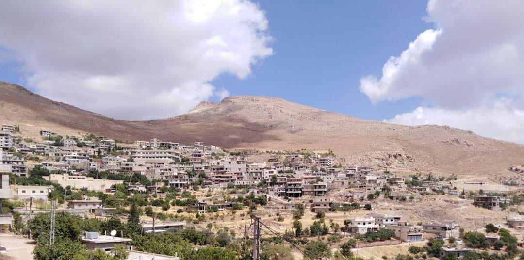
Umm Bieh Village
A Syrian village located in Rif Dimashq Governorate. It is one of the villages of Mount Hermon, and its residents live on agriculture and livestock farming.
Sahnaya Town
Sahnaya is a Syrian town located in the Western Ghouta, and it is administratively affiliated with the Daraya district. The town rises 700 meters above sea level, and the Awaj River passes through it, irrigating its land and orchards. It is full of trees and orchards and is considered a tourist area and a refuge for the people of Damascus to escape the noise of the city. It is close to the cities of Daraya and Moadamiyat al-Sham. The population of Sahnaya according to the 2007 census is about 8,500. Sahnaya is one of the villages of the Western Ghouta, which forms the western part of the Damascus basin, and is part of the inland plateaus. It is also distinguished by the purity of its air and the cleanliness of its land, fruits, and vegetables. It is bordered to the north by the city of Daraya, to the south by the cities of Al-Kiswah and Marana, to the west by Jdeidat Artouz and Kawkab, and to the east by Ashrafiyat Sahnaya and the international highway going from Damascus to Daraa - Jordan. The town of Sahnaya is about 12 km from the center of Damascus. There are many public, educational, religious, and other facilities in Sahnaya. The city contains the "Saint Elias the Zealous Church," the "Sisters of Charity Convent," and the "Sheikh al-Allamah Amin Sweid Mosque," in addition to a place of worship for the Druze Unitarian community. There is also a train station in the town on the Damascus - Daraa railway line. Sahnaya is also distinguished by the presence of an olive forest in its western side, which is one of the landmarks of Sahnaya, although it is receding due to neglect and the desire of the olive owners among the town's residents to build. There are also five schools in Sahnaya, two for the primary and middle stages, and three general, commercial, and industrial high schools.
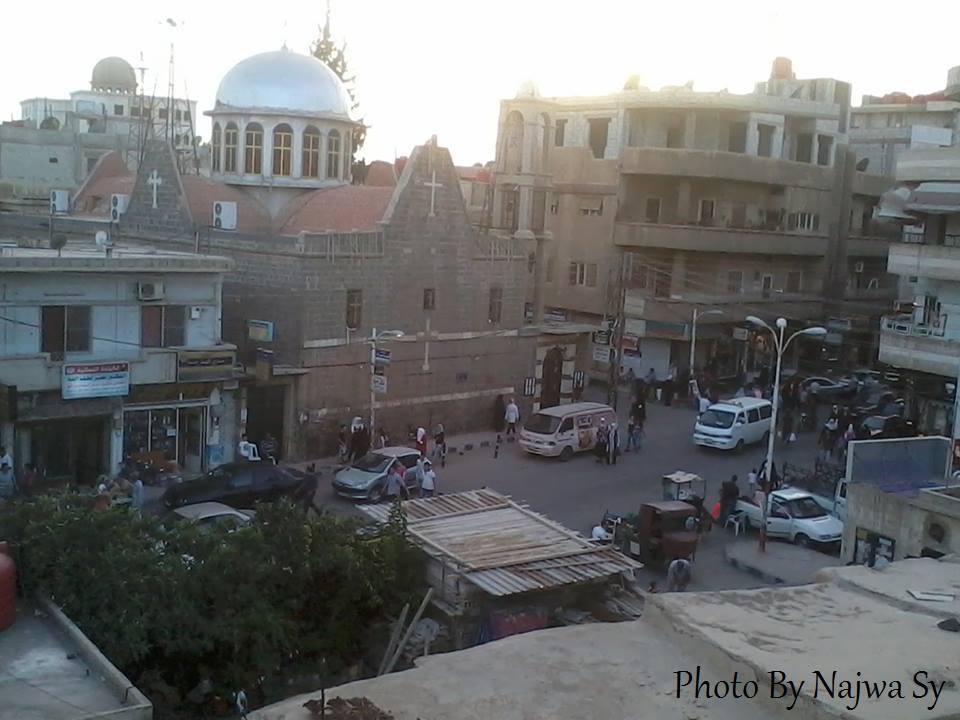
Moghr al-Mir Village
A village in Rif Dimashq Governorate. Its inhabitants settled there in the early thirties of the last century, when some came from a mountainous village called "Ain al-Shaara," and they had properties in a village called "Dawreen" located on the road leading to the Quneitra Governorate in rugged terrain. "Moghr al-Mir" is located in the middle of the road between "Dawreen" and "Ain al-Shaara." Others came from a nearby mountainous village called "Hayna" and formed a small community of no more than a hundred people. They worked in the plains owned by other villages until those who were well-off bought a part of it and began to benefit from the riches of its land, while others rented land from owners who were not originally living in the village. Then the villagers sold their properties in "Dawreen" and bought properties in their own village. Its population is currently about 600. Many of its young people leave it after marriage and reside in the suburbs of the capital due to their government jobs. The families present in the village are: Hamdan, Ammar, Radi, Indiwi, Abu Hamid, Jabr, Hamid, Baraka, Nasr al-Din, Mazhar, Hassoun, Shadid, and Abu Daqa. The people of the village rely on cereal crops and winter harvests, as the Awaj River, which passes adjacent to the village, irrigates most of its plains. There are three springs next to it; two are permanent: "Al-Suyouf" and "Al-Tamathiyah," which irrigate a small part of its land, and the seasonal "Awaj" spring, which irrigates most of its lands before the last two months of summer. Two decades ago, the village farmers planted fruit trees and cared for them until they became a good source of livelihood, which improved the standard of living for the people of the village, and they worked to modernize agricultural work using modern machines.
Suhaita Village
The history of the village of Suhaita dates back to before the Assyrian rule of the land of Canaan in 700 BC, which is the earliest history in which Suhaita was mentioned as an area where humans built and established a permanent life. The word "Suhaita" is an Aramaic-Syriac name meaning "the bathed" (the one that is showered), which is an expression for heavy rainfall; this town was called the "bathed town" due to its heavy rainfall. The village of Suhaita is located southeast of the town of Majdal Shams in the Golan. It is bordered to the north by Mount Hermon, the village of Hader, and Jubata al-Khashab; to the west by Majdal Shams and Mas'ade; and to the south by the village of Buq'ata. The total area of its agricultural land reached 30,000 dunams. The population in 1967 reached about 60 families, or about 300 people. They worked in agriculture and livestock and cattle farming. By virtue of the quality and fertility of its lands, it became famous for producing vines, grapes, and apples, relying on the main water springs. Ancient Roman caves are spread throughout the village, and it contains three very old grape presses made of limestone, and a large number of scattered wells also carved into the rock, 3 meters deep and 1.5-2 meters in diameter. There are also stone burial sites and fire pits carved into the rock. After the 1967 war, the residents of Suhaita village were moved to the Syrian army and officer housing in the village of Mas'ade, and the rest to the village of Buq'ata, after the residents of the two villages agreed to host them temporarily, on the condition that the ownership of their lands and the freedom to use and dispose of them remained...
Among the martyrs of Suhaita village in the Syrian revolution against the French colonizer in 1925 is the martyr Fouad Salim Bek, one of the leaders of the revolution, born in Lebanon. He was martyred in the village of Suhaita, and his tomb is still there inside minefields from the remnants of the war. The last time a wreath was placed on his grave was by his daughter, days before the 1967 war.
Qal'at Jandal Village
Qal'at Jandal town is affiliated with Rif Dimashq Governorate and is one of the villages of Mount Hermon (Jabal el-Sheikh). It is surrounded by the following villages and towns: Asim al-Fawqa, Buqasam, Khirbet Ain Sukkar, and Ain al-Burj. It is considered one of the tourist areas in Rif Dimashq Governorate. It is a small village located 50 km southwest of Damascus, on the slope of Mount Hermon. Its name comes from the old castle dating back to the Aramaic era, of which almost nothing remains.
The village rises 750 meters above sea level and is on the slope of Mount Hermon. The village is considered one of the beautiful summer resorts close to Damascus.
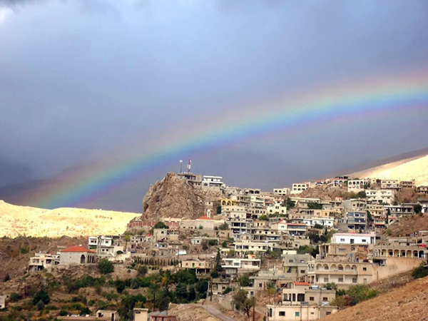
Al-Rima Village
Al-Rima village is a village affiliated with the Qatana district in Rif Dimashq Governorate. It is located in the Mount Hermon area. Its most important landmark is the Awaj River, which originates from it. Apples, cherries, and fruits in general are grown there, and it is characterized by many springs. It is a very beautiful village and enjoys a distinctive tourist location, as it is centered on a high hill connected from the west to the slopes of Mount Hermon, while valleys surround it from the east, north, and south, which in turn contain many watercourses, the most important of which is the Awaj River. These rivers and streams irrigate the surrounding agricultural lands. The residents of Al-Rima village rely on agriculture for their livelihood. Their farming includes all fruit trees that require a cold mountainous climate such as pome fruits, stone fruits, vines, olives, mulberries, figs, and pomegranates. In addition to some field crops such as wheat, corn, and vegetables. The villagers also work in trade and simple industrial jobs, and the village contains some tourist sites. The population of the village is about 1,400. The lands of the village connect with the lands of the neighboring villages, which are Arneh, Buqasam, Darbal, and Khirbet al-Sawda.
Harfa Village
A village affiliated with the Qatana district in Rif Dimashq Governorate. It is located to the east of Mount Hermon and is 50 km from Damascus.
Harfa village is located on a high hill of the hills of "Mount Hermon," where one can see the governorates of "Damascus, Rif Dimashq, and Quneitra." The population of the village is about 3,000, who live in an atmosphere of religious brotherhood, social compassion, and kinship. Young people from the village work in cities, and some are in exile: in the United States of America, the United Arab Emirates, Saudi Arabia, Qatar, and others. There are many springs in the village that burst in the winter and spring, such as "Ain Mohsen" and "Marah al-Zein" spring.
There are some ancient archaeological sites in the village such as olive and grape presses and a Roman monastery, as well as a number of ancient olive trees that are hundreds of years old, in addition to many caves and grottoes inhabited by humans in early eras. The village is famous for agriculture, and the olive tree is at the forefront of crops. Today, the village is witnessing the spread of fruit tree cultivation, such as apples and cherries. The people of the village were famous for raising livestock, such as sheep, goats, cattle, and poultry, to benefit from their meat and milk, as they were the second source of food for people after agriculture. The total reclaimed land reached about 5,000 dunams by 2008, most of which is planted with olive, vine, apple, and fig trees, and a portion is planted with cereals. In the village of "Harfa," there is a primary, middle, and high school, in addition to a medical point that provides medical and therapeutic services to citizens for free. The village has enjoyed the blessing of electricity since 1974. The village is connected by a network of roads that link it to the "Quneitra and Rif Dimashq" governorates.
Rakhleh Village
A town affiliated with the city of Qatana in Rif Dimashq Governorate, and it is one of the villages of Mount Hermon (Jabal el-Sheikh). It is located east of the Syrian-Lebanese border, at an altitude of 1550 m above sea level. The villages closest to it are the Syrian town of Burqash and the Lebanese Kfar Qoq. There are some ancient ruins near it, including an old castle on the eastern slopes of Mount Hermon in the Qatana area of Rif Dimashq Governorate. It stands on a rocky hill, south of the village of "Rakhleh" at a distance of 4 km. It is also about 19 km from the city of Qatana in the northwest direction. It was built of large limestone rocks and consists of two parts, northern and southern. On the capitals of its columns are carvings of grape clusters and plant leaves from the Roman era. Stone coffins with relief sculptures were also inscribed there, and it contains a large church (basilica) from the Byzantine era, some of which is built of stone and some is carved into the solid rock. It is believed that this church was built on the ruins of an ancient pagan temple, and inside the castle there are huge rock reservoirs for water and wells with wide bases.
Aysam Village
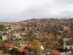
Aysam is a town in Rif Dimashq Governorate in Syria. It is located southwest of Damascus on the road to Quneitra and is an ancient village with a long history. The majority of its residents work in agriculture.
Hayna Village
Hayna town is affiliated with the Qatana district in Rif Dimashq Governorate. It is one of the villages of Mount Hermon (Jabal el-Sheikh), located near the archaeological Tel Hayna, and rises 1080 m above sea level. It contains some archaeological monuments dating back to the era of Queen "Helena," and its name comes from "Hanat al-Khamr" (wine tavern) due to the presence of ancient presses dating back to the Roman era. Its population is about 5,000, and it is surrounded by the following villages and towns: Darbal, Kafr Hawr, Moghr al-Mir, and Ain al-Shaara.
It is famous for the cultivation of anise, grapes, figs, and olives and is considered one of the tourist areas in Rif Dimashq; it is 65 km from Damascus. It is inhabited by the following families: Azar, Helena, Haidar, Al-Baba, Farah, Bishara, Subeih, Jubran, Marsha, Obeid, Al-Hasaniya, Masoud, Salloum, Abu Nassar, Al-Bahri, Abu Saab, Abu Younes, Murad, Al-Harshawi, Dhawabi, Hamid, Zaher al-Din, Tannous, Muhanna, Al-Homsi, and Abu Asali. There are also Lebanese families who lived in the village and still hold Lebanese citizenship, such as: Makhoul, Al-Shweiri, Romans, and Awad.
Khirbet al-Sawda Village
Khirbet al-Sawda is a Syrian village located in Rif Dimashq Governorate; it is administratively affiliated with the Sa'sa' sub-district in the Qatana area.
Al-Maqrousa Village
A Syrian village located in Rif Dimashq Governorate. It sits on flat plains, adjacent to Mount Hermon. The population is about 1,300, living in an atmosphere of religious brotherhood, social compassion, and kinship. Among the village's families are: Tulay'a, Saqr, Abu Daqa, Abd al-Hay, Al-Halabi, and others. There is a primary school in the village, which is decades old, in addition to many places of worship, caves, and grottoes inhabited by humans in early eras. The village is famous for agriculture, and apple and olive trees are at the forefront of crops.
Hals Village
One of the villages of Mount Hermon, located close to the village of Hader. Its population is about 500, and some of the village's residents work in agriculture.
Reference: Al-Amama Magazine