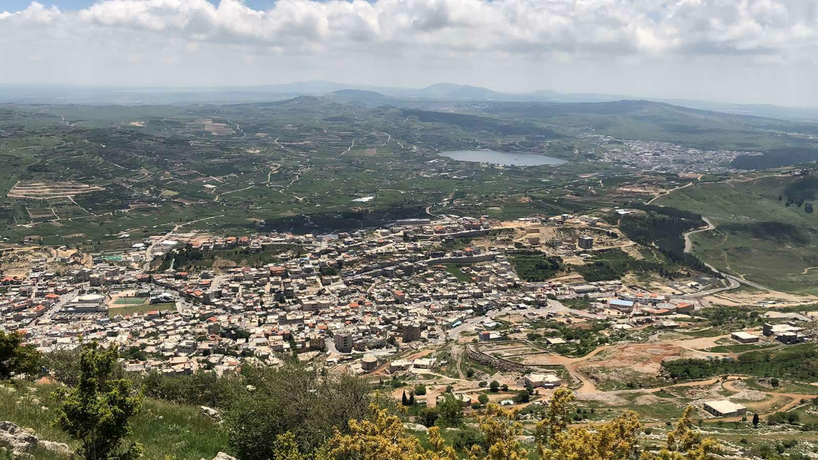

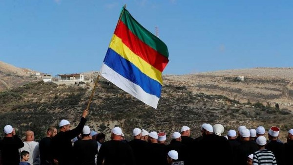
The history of the Druze in the Golan region dates back to the era of Emir Fakhr al-Din al-Ma'ni II (1590-1635), who sought independence from the Ottoman Empire. He requested Ali Janbulad to migrate from the Aleppo area to the Carmel and Golan regions to settle the Druze there.
The Golan is a plateau located in the Levant, between the Yarmouk River to the south and Mount Hermon to the north, administratively belonging to the Quneitra Governorate; it is a part of and belongs to Syria. Since the 1967 war, the Israeli army has occupied two-thirds of its area, and it has since been considered by the United Nations as occupied Syrian territory.
The Druze remained on their land in the Golan despite being under occupation, refusing to carry Israeli identity cards, always expressing their attachment to and belonging to Syria.
The Druze in the Golan are distributed across 4 main villages: Majdal Shams, Buq'ata, Mas'ade, and Ein Qunya. Here is a brief overview of their history:
Majdal Shams Village
Majdal Shams is the largest village in the Golan's Jabal al-Shaykh (Hermon) region, located on the southern slope of Mount Hermon. Its population is approximately 15,000, and it sits at an elevation of about 1,200 meters above sea level. During the Ottoman rule, Majdal Shams, along with the rest of the region, was part of the Mount Lebanon Governorate, Rashaya District. After the French Mandate, it became part of the Damascus Governorate, Syria.
Its name dates back to the Phoenician era and means in Arabic "Tower of the Sun," as traces of a Phoenician temple dedicated to the Sun god and an olive press were found there. It is believed that King Hiram of Tyre ordered the construction of a sun temple in this location after a hunting trip on Mount Hermon. After the Phoenician era, it turned into a ruin and remained abandoned until the late 13th century, when three brothers from the Farhat family—who were of Egyptian origin—arrived via Palestine. After the Mamluks, led by Baibars, entered the city of Safed, other Druze and Orthodox Christian families migrated to Majdal Shams, the largest of which were the Safadi and Shehada families. In the mid-18th century, other tribes arrived in Majdal Shams from Mount Lebanon after their defeat in the Battle of Ain Dara and the bloody civil war between the Shihabs and the Ma'nis of the Lebanese Druze. One of the largest of these tribes was the Abu Saleh family, whose origins trace back to Aleppo and the Hamdanid tribes; today, the Abu Saleh family is the largest in Majdal Shams.
However, there is another narrative passed down among the local residents: that three brothers from the Farhat family sought refuge on Mount Hermon and inhabited the ruins of Majdal Shams, fleeing the Galilee region in Palestine after one of them accidentally killed a man, forcing them to leave to avoid the retaliation of the victim's family. This narrative, still alive and shared by the region's inhabitants, traces the arrival of the Farhat family in Majdal Shams to the Roman period before the Islamic conquest, as the Mount Hermon region was historically one of the recognized areas of refuge mentioned in the Torah and noted by ancient historians such as Flavius Josephus, Philo, and others.
During the Great Syrian Revolt against the French Mandate, Majdal Shams was one of the most important strongholds for rebels from the Golan and Mount Lebanon due to its fortified mountain location, and the French burned it three times.
Residents of Majdal Shams rely primarily on the cultivation of vegetables and fruits, especially apples and cherries.
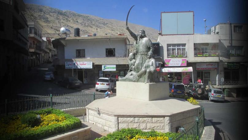
After the 1967 war, Israel occupied the Golan Heights, including Majdal Shams, and it remains under occupation. In 1982, the occupation authority attempted to forcibly impose Israeli citizenship on its residents and those of other Golan villages, but failed due to the residents' rallying around the spiritual leadership, which issued a fatwa declaring anyone who accepted Israeli citizenship an apostate and boycotting them. Israeli forces besieged the Golan villages, especially Majdal Shams, for over six months, preventing food and medicine from entering. However, this only strengthened the citizens' resolve and refusal of the occupation's demands; they raised the Syrian flag and issued an official document in the name of all residents declaring their adherence to their Syrian Arab nationality and their rejection of the occupation. In July 2010, Israeli police were forced to withdraw from Majdal Shams following clashes with residents in the vicinity of a house they had raided for search, which angered the locals and led them to surround and detain the police officers. This prompted the Israeli army to intervene. The detained police were released after the village elders obtained guarantees that such raids by the police would not be repeated and that the sanctity of homes and civilians would be respected.
It is the largest of the five Golan villages occupied by Israel. The total population of the five villages is approximately 30,000, of whom about 15,000 live in Majdal Shams and the rest are distributed among the other four villages (Buq'ata, Ein Qunya, Ghajar, Mas'ade).
Buq'ata Village
Buq'ata is a Druze village located on the Golan Heights at an altitude of 1,000 meters above sea level, ten kilometers north of the city of Quneitra and five kilometers east of Mas'ade, situated on the main road leading from Majdal Shams to Mas'ade in the south and to Quneitra. It lies on a small plateau in a flat plain with reddish-black soil and black stones.
Around the village are some small mountains resembling hills, such as Jabal Shu'aythira to the east and Ein Warda to the northeast, a meadow called the Western Meadow to the north, and to the west is a hill called the Red Hill, which overlooks the Ghor and Hula region. East of the town is a spring called Ein al-Salalim, and there are some wells in the village. Previously, water was collected in ponds and marshes that would dry up in the summer, and it was surrounded by groves and orchards, with some small caves.
The source of the name is unclear, but it is believed that its existence as a flat area with some spots (buqa') or water basins was the reason for naming it Buq'ata over time to denote this phenomenon. It has been inhabited since ancient times, as evidenced by the caves and ancient ruins found there, although the village is not mentioned in ancient historical sources. It is believed that Druze settlement began there more than a hundred years ago, when some families from Majdal Shams were forced to move to that area to live due to a bloody family dispute that occurred in 1875. Residents from Jabal al-Druze, Lebanon, and the Safed region joined them, forming an independent village that continues to exist today.
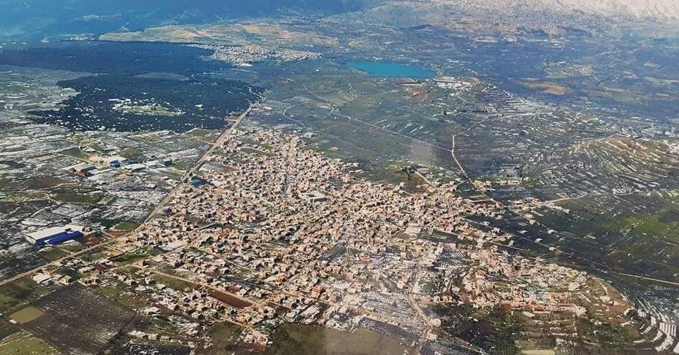
The village suffered greatly in 1888 when Ottoman authorities attacked it, and it suffered again in 1925 during the Great Syrian Revolt, as most of its houses were destroyed and the majority of the population took refuge in Jabal al-Druze and the Carmel, returning afterward.
Several mukhtars managed its affairs until 1975, when the first local council was appointed to begin serving the citizens, securing their needs, and looking after their interests. The village was connected to the power grid, an elementary school was built in 1950, and a middle school in 1987. Its children study at the high school in Mas'ade. Streets were paved, and the local council building, clinics, and important social facilities were established. The large pond that once occupied the center of the village and was used to water livestock has been drained.
Its population reached 5,523 according to a census conducted in September 2007, divided by families as follows:
Amasha (includes Najm, Abbas, and Shahrour: 959), Abu Awad (includes Zeidan: 815), Abu Shaheen: 596, Zahwa (includes Khattar: 596), Shams: 419, Farhat: 365, Wali: 228, Al-Qish: 227, Murad + Nasser: 173, Abu Shibli: 195, Sobh: 151, Qal'ani: 117, Tarabieh: 113, Ghutani: 108, Harfani: 94, Habous: 77, Hassoun: 70, Abu Rafe': 62, Darwish: 54, Batheesh: 51, Maghrebi: 36, Hasas: 17, Al-Shaer: 9, Safadi: 9, Jaber: 7, Bishara: 6, Zeidank: 4, and Al-Qadi: 4.
Mas'ade Village
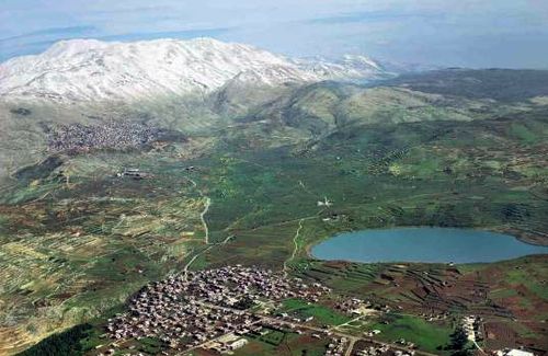
Mas'ade is a Syrian village in the occupied Golan, located in its north a short distance west of Birkat Ram (Lake Mas'ade). The village of Mas'ade lies on volcanic land, 970 meters above sea level.
The houses of the village are situated in the northern area on low-lying land. To the east, it is bordered by Wadi Abu Sa'id, while forests border it to the west and south, and its land slopes toward Wadi Sa'ar, which borders it to the north.
Mas'ade village served as a sub-district center before 1967 and belongs to the Syrian Quneitra Governorate. It had social services that benefited the residents of the village and those administratively attached to it. The village fell under occupation in 1967.
Ein Qunya Village
Ein Qunya is considered one of the old villages in Syria. The exact year of its establishment is not known, but it may date back hundreds of years, thanks to the existence of remnants of ruins that still bear witness to its grandeur, such as the wheat mills located next to the Sa'ar River. There was also an old tower in the center of the village, which was demolished years ago due to development work in the town. Additionally, there are remnants of very old, demolished houses that still exist today.
Ein Qunya was named for the abundance of water eyes (springs) in the town. In 1967, a large number of its residents were displaced in the aftermath of the June war, and its population today is estimated at nearly 2,000. Residents rely for their livelihood on freelance work, agriculture, and industry. The most important fruit trees that the residents depend on for their agriculture are olive, peach, and nectarine trees.
Ein Qunya village is located a few kilometers northwest of the village of Mas'ade, on the western slope of Jabal al-Qati'—it overlooks the Banias area and the Hula Valley to the west. Its elevation is about 700 meters above sea level. Its climate is cold in winter and hot in summer. Ein Qunya village was built on a high hill bordered to the east by Jabal al-Qati' (Al-Quba'), to the west by Banias, to the north by the shrine of Nabi Hazouri, and to the south by the Sa'ar River. Its stones are hard limestone in most places, except east of the river where there are hard volcanic stones.