
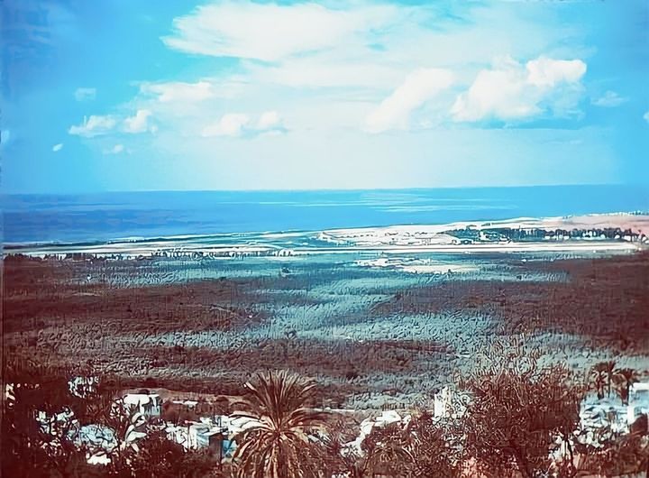
The "Lebanon Archive" page published an old photograph of what the Choueifat desert looked like in the 1970s.
Choueifat used to enjoy the largest olive forest, extending from the Hadath area in the north to Khalde in the south, reaching the borders of "Beirut International Airport," which appears in the depth of the image.
The Lebanese historian Philip Hitti described it as one of the largest olive forests in the world, after the forests of Spain and Southern California. He pointed out that the residents of Choueifat used to say that their villages (neighborhoods of Choueifat) overlooked three seas: a green sea, which was the olive trees; a red sea, which was the sand of the Choueifat desert; and a blue sea, which was the Mediterranean.
The page adds: "But unfortunately, nothing remains of Choueifat's green sea except the memory of that photograph. The civil war left its mark, and haphazard concrete construction gnawed away at every green thing in this city. Every olive grove in this desert had its own name, and in it, there was a 'mantara,' which is a small primitive structure where a watchman—appointed by the owner to oversee the grove—would take shelter and sleep. Among the names of those mantaras were: Al-Zaghal, Al-Yatoun, Al-Marah, Dahr Al-Rihan, Maskita, Al-Suwaydi, Qal'at Sha'bana, Karkoun Al-Sahra, and Jal Al-Sullam (later named Hayy Al-Sullam), where Saadallah Al-Khoury owned groves that were terraced like a ladder. By the mid-1940s, the Choueifat desert contained about 53,600 olive trees, according to a census by the owners' committee, which entrusted its watchmen to count the trees within their respective mantaras. In the Choueifat desert, there were 34 olive presses working in the traditional old way, day and night, during the olive harvest seasons. In addition to the olive trees, the desert had 12,500 carob trees."